THE WILDERNESS ROAD” sums up the iconic meaning of the lives of Daniel Boone and the thousands of settlers who poured after him though the great gap into Kentucky. In its various forms as frontier trail, wagon road, stage route, and antebellum turnpike, the road directed pilgrims and travelers to the West. Whatever your background, as the starting point for the settlement of the West, the Great Migration Route over the Cumberland Gap tells your story as an American.
Bell County
The Tennessee General Assembly formed Claiborne County in 1801 from parts of Grainger and Hawkins Counties and named it for William C.C. Claiborne, Tennessee's first congressional representative. The most important historic feature of Claiborne County is the Cumberland Gap, located south of the convergence of Tennessee, Virginia, and Kentucky. Native Americans called this natural gateway to the north and west the "Warrior's Path." In 1750 Dr. Thomas Walker claimed discovery of the gap and named it Cumberland Gap in honor of William Augustus, Duke of Cumberland, the son of King George II and Queen Caroline. In 1775 Daniel Boone led thirty men through the gap and opened a road west to settlement.
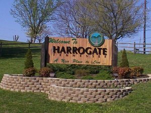
Claiborne County

The Boone Trace
The Boone Trace is a tourism corridor from The Cumberland Gap to Fort Boonesborough, KY, 120 miles away. It follows the pathway that Daniel Boone blazed in 1775 to bring the first settlers in the wilderness destined to be Kentucky.
CUMBERLAND GAP

In 1750, Dr. Thomas Walker, an English naturalist and scientist, led a small party of explorers to the Gap after hearing Native American descriptions of the pathway through, rather than over the mountains. In 1769, Daniel Boone explored the area and in 1775 he blazed the 200-mile trail known as Boone's Path or Boone's Road. The trail, beginning at the Gap, passed through Virginia to Kentucky's Bluegrass Region.
CUMBERLAND GAP TUNNEL

The Cumberland Gap Tunnel opened to highway traffic on October 18, 1996. The tunnels are located in the Cumberland Mountains of the Appalachian Range, where the states of Kentucky, Tennessee and Virginia converge.

Tazewell, TN
The Claiborne County Jail in Tazewell, Tennessee, is a historic jail that is listed on the National Register of Historic Places. The two-story limestone and brick jail was built in 1819. It replaced Claiborne County's first jail, a crude structure built on the same site in 1804. The 1819 jail was used until 1931.[2] It was listed on the National Register in 2007.[1]

Bell County is located in the southeastern corner of Kentucky where the state meets Tennessee and Virginia. Its 361 square miles are dominated by two mountain ridges, Pine Mountain and Cumberland Mountain, and the fault which slices both of these, creating the Cumberland Gap and the Narrows.

Hensley Settlement
In 1903, the Hensley family settled atop Brush Mountain, forsaking settled areas for an entirely self-sufficient way of life. This truly rural Appalachian settlement continued, without electricity, indoor plumbing, roads or any modern conveniences until the last inhabitant left in 1951.
Approximately 25 of the original buildings have been restored and the surrounding land has been returned to the original farming and pasture scene of its original appearance.
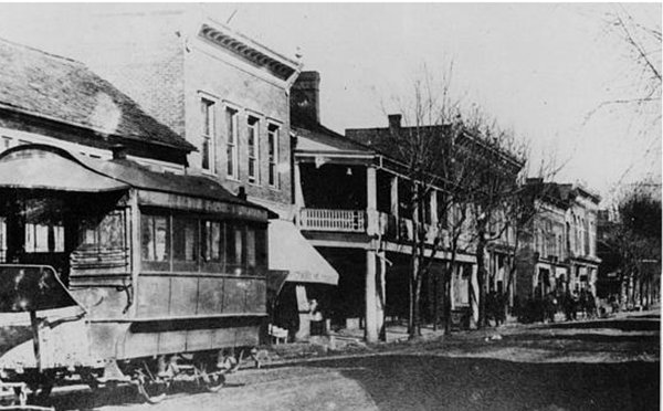
In 1886 a charismatic Canadian of Scottish descent, Alexander Alan Arthur, visited the area around Cumberland Gap to assess the possibility of extending a rail line from Morristown westward. He was so impressed with the area and its potential that he immediately began organizing a group of investors to take options on hundreds of areas around and near the Gap. Arthur was able to convince his original investors to send him to England where he was able to garner more than adequate investment for a new company, the American Association, Ltd., which would invest in the rich lands he had optioned.
Grainger County

Bean Station
“In the spring of 1775, two men stood looking down from the top of Clinch Mountain in Eastern Tennessee into “one of the most beatiful spots in the world, a pictureque little valley with myriad of intervening hills appearing like broken waves on a vast ocean of green.
It was a scene that would long remain in the minds of Daniel Boone and William Bean who were on a pioneering journey. Bean was looking for a place to settle, to bring his family and eastablish a home.” For the full story, click on the "learn more" tab below.
Lee County

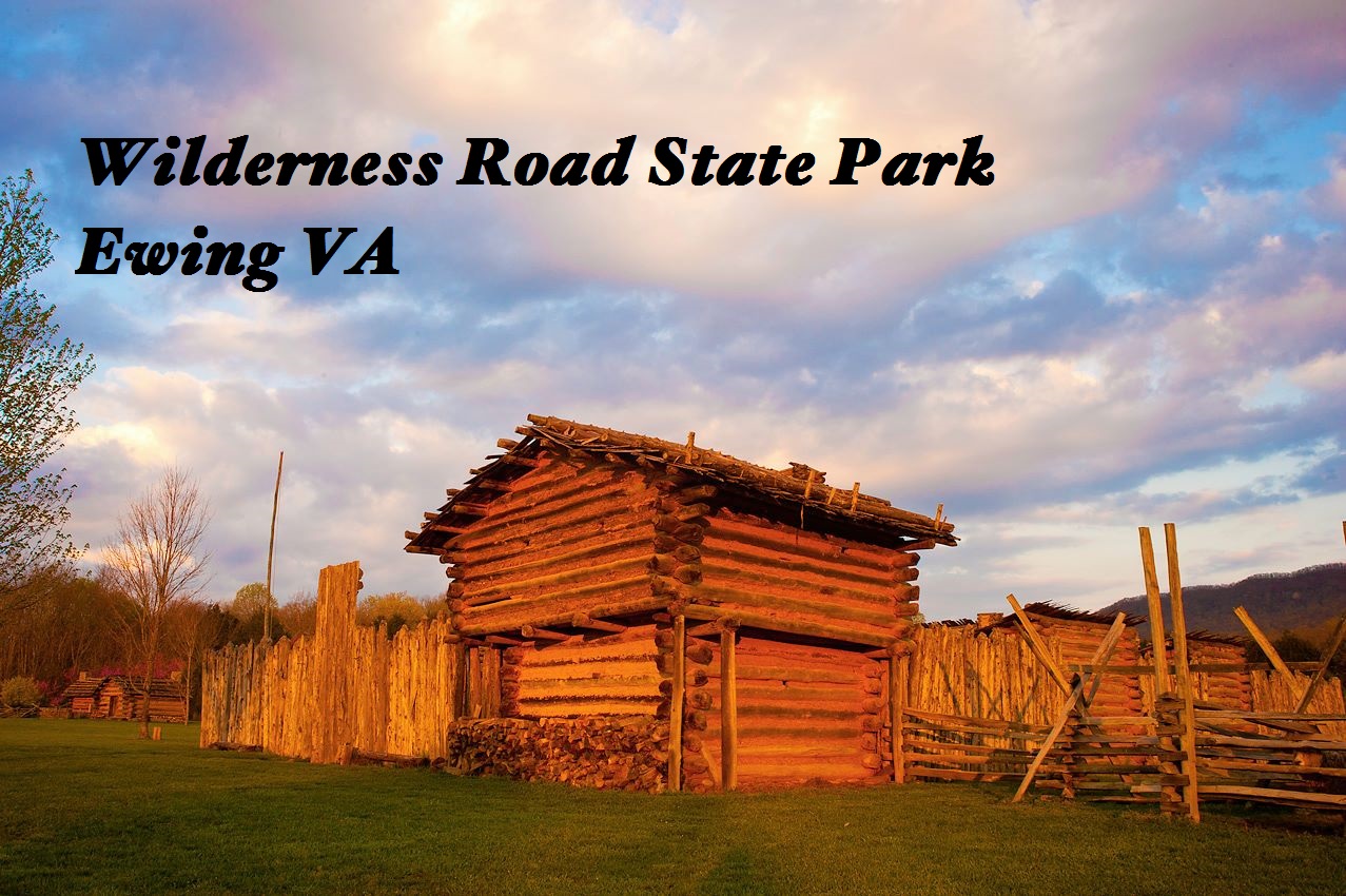
Historic Martin's Station
Wilderness Road State Park
Historic Martin's Station is an outdoor living history museum at Wilderness Road State Park featuring the most authentically re-constructed frontier fort in America. Virginia's frontier comes alive with costumed interpreters providing demonstrations depicting life in colonial America. And as you leave this small frontier settlement, you may find yourself looking back one last time, and you will soon realize that not only have you touched history, history has touched you!